The East Selkirk Roadhouse geocache site is located in East Selkirk, Manitoba at GPS coordinates N 50° 07.800 W 096° 49.141.
Sir Sanford Fleming, surveyor for the CPR, first chose Selkirk as the Red River crossing for the Canadian Pacific Railway. Unlike Winnipeg, this land did not routinely flood.
In 1879 the Government of Canada built the East Selkirk Roundhouse in anticipation of the coming railway. With four brick wings and a basement, the building measured 90 feet wide by 180 feet long and reached as high as 30 feet in the roundabout area at the center. The project cost $60 000.00.
However, in April 1879, when Canada re-elected Sir John A. MacDonald’s Conservative government, the railroad crossing was changed to Winnipeg. For 20 years the Roundhouse went unused.
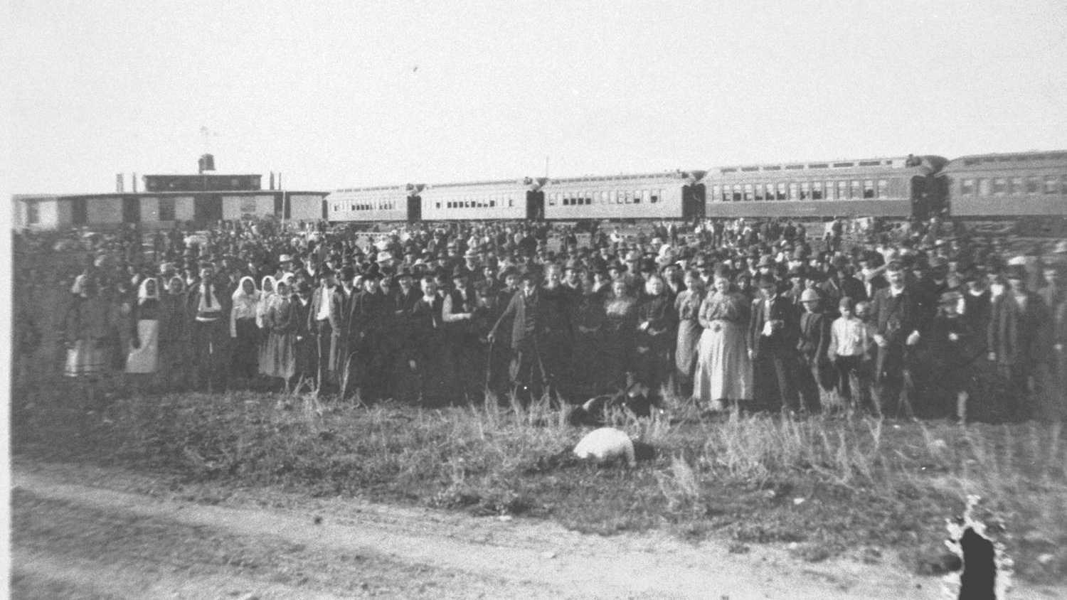
In the late fall of 1898 W. McCreary, Commissioner of Immigration in Winnipeg, decided to turn the roundhouse into an immigration shed. Renovations cost $2 000. The additions included a second floor for the children, cooking facilities, and sanitary necessities. The Roundhouse could accommodate 1500-2000 immigrants. The East Selkirk Immigration shed officially became operational in 1899.
The first wave of immigrants included 1700 Doukhobors, and the second wave included 600 Galicians (Ukrainians); thousands of immigrants arrived over the next few years.
By 1906 the Roundhouse was closed as an immigration shed, but was subsequently used as a dance hall, recreation hall, school, church, a general meeting place, and most famously as an indoor skating rink.
In 1916, the building was demolished and much of the stone from the building was used to build the first two-story Happy Thought School on old Henderson highway.