What is today rich farmland and delightful bush was once covered by a vast glacier and the lake that came out of it.
Located along Lake Winnipeg, Grand Beach Provincial Park contains some of the most beautiful sandy beaches in North America. However, unknown to many, this area was once home to an ancient beach that ran along Glacial Lake Agassiz.
Lake Agassiz at its greatest extent covered 440,000 square kilometers – larger than any currently existing lake in the world, including the Caspian Sea. About 9,000 years ago the water level of the lake dropped enough to reveal the top of the Belair Moraine, a hill-shaped landform deposited here by glacial activity more than 14,000 years ago.
As the lake’s level lowered over a period of several thousand years, its powerful waves eroded the shoreline of the moraine island. As sand and silt were eroded, large granite boulders brought by glaciers from the Precambrian Shield along east Lake Winnipeg were exposed. The sand and silt eventually settled forming the famous Grand Beach. Although there is no longer any sand on the surface of this ancient beach, you can still find the sand of the Belair Moraine beneath the pine needles and thin layer of soil.
Approximately 8,000 years ago, the Lake had all but disappeared. The only remnant of Lake Agassiz includes Lake Winnipeg, which is currently the World’s 12th largest freshwater lake (the 6th largest in Canada).
“Today the only sound resembling waves is the occasional sound of wind in the treetops. Perhaps it is the wind looking for its vanished lake and hidden shorelines.”
– Grand Beach Tourism
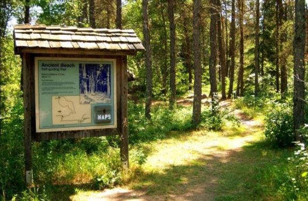
Ancient Beach
Lake Agassiz geocache site is located near Grand Marais, Manitoba, Canada at N 50º 34.075´ latitude and W 96º 34.946´ longitude. If you find the geocache and scan the QR code inside of it, it brings you here to learn more. Watch all of our videos on our YouTube Channel. Other heritage content can be found on our Red River North Heritage Youtube channel.
Transcription:
From the geocache site, find the hill to look out over Lake Winnipeg. This is the same view you would’ve had of the water at the edge of the ice-age era Lake Agassiz.
This location was called Belair Moraine, a hill-shaped landform deposited here by glacial activity. The melting of the glacier that covered a large portion of Manitoba created a lake that covered much of the province.
Geologist Warren Upham dubbed it Lake Agassiz after American scientist Louis Agassiz in 1879.
When the lake started to melt, the southwestern corner of the province was the first to be exposed. When an eastern outlet opened, Agassiz drained rapidly, probably with catastrophic results.
As much as 3000 cubic kilometers of water, seven times the volume of Lake Erie, coursed into the superior basin in just a few weeks. From this point, Lake Agassiz continued to drain to the north, creating a series of beaches which bear the names of local towns. Macauleyville, The Pas, Lower Pas, and Gimli.
A process known as isostatic rebound sped up the emptying of Lake Agassiz into Hudson Bay. As the ice and water that had compressed the Earth’s crust was removed, the land returned to its pre-glacial elevation.
When the process was complete, only Lakes Winnipeg, Winnipegosis, and Manitoba’s other great lakes remained as vestiges of their glacial forerunner.
The ridges near the beaches hindered the drainage of water to lakes in the east, forming extensive bogs and sloughs behind them, and making east-west travel difficult. At the same time, however, the well-drained beaches served as natural north-south migration corridors.
Nineteenth century explorers such as Henry Hind noted that these pitching tracks were often the only roads in the low-lying country of southern Manitoba.
The beaches also served as lookout stations for indigenous hunters to spot approaching game. The ridges provided strategic locations for camps, as they traversed the resource areas of the western grasslands and eastern streams and forests.