Today most Canadians can easily identify the size and shape of the Province of Manitoba. However, when the province was first created it was only 1/18th of its current size. The original boundaries of the Province of Manitoba made it look like a fine little postage stamp on the map of the Dominion of Canada.
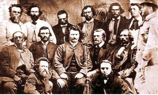
In 1869 Rupert’s Land, which consisted of all lands draining into Hudson Bay, was purchased by Canada. The Red River settlement, which had a population of about 12,000 people, were outraged that they were not considered or included in these negotiations. Their elected leader, Louis Riel, established his own provisional government as part of The Red River Rebellion. A dramatic and heated argument ensued, and eventual negotiations between the provisional government and the Canadian government resulted in the creation of the Province of Manitoba.
On July 15, 1870, Manitoba officially entered confederation as a Canadian province. It measured 130 miles from east to west and 110 miles from north to south. The total area included 13,928 square miles. When viewed on a map of Canada the area looked no larger than a postage stamp. Because of its size, its nickname became the “Postage Stamp” province.
In 1881 and 1912, the Provincial boundary was extended to roughly form its current shape. It was not until 1955 that the boundary between Ontario and Manitoba was finalized. It took 74 years and 43 Dominion-Provincial Acts and Orders-in-Council to settle the final Manitoba provincial boundary.

Postage Stamp Province – The North East Corner
This cache is currently located at the original Northeast corner of the original “Postage Stamp” province; on the corner of highway 59 and Fey Road.
The Postage Stamp Province geocache site is located in Grand Marais, Manitoba, Canada at N 50º 31.890´ latitude and W 96º 32.262´ longitude. If you find the geocache and scan the QR code inside of it, it brings you here to learn more. Watch all of our videos on our YouTube Channel. Other heritage content can be found on our Red River North Heritage Youtube channel.
Transcription:
The same month Colonel Wolseley’s Red River expedition left Toronto to stabilize Red River in the wake of the Riel Rebellion, the dominion parliament debated the bill that would become The Manitoba Act of 1870.
The following excerpts are taken from The Globe, a predecessor of today’s Globe and Mail, on 3rd May 1870.
Shortly after the meeting of the house yesterday afternoon, Sir John A. MacDonald introduced the long expected an oft delayed bill for the government of the Northwest Territory. It is considered proper, he said, that the province which is to be organized should be called Manitoba.
The name Assiniboia, which it had hitherto been called, is considered to be rather too long, involving confusion, too, between the River Assiniboia and the province of Assiniboia.
I suppose, therefore, there will be no objection to the name that has been fixed upon, which is euphonious enough itself, and is an old Indian name, meaning “the God who speaks”, “the speaking God”.
There is a fine lake there called Lake Manitoba, which forms the western boundary of the province.
Sir John here placed a map on the table showing boundaries of the new province, and members gathered round to examine it. “How many square miles are there in the new province?” asked the honourable Mr. Gray. “Eleven thousand square miles” was MacDonald’s reply.
“It is a small province, as the house will observe, but yet it contains the principal part of the settlements, which are arranged, as those who have studied the matter know, along the banks of the Red River and the banks of the Assiniboine, and the point of their confluence at or near Fort Garry, up westwards, toward Lake Manitoba.”