Site 01: Bunn’s Road
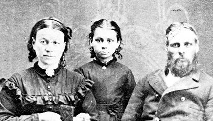
Hear Rachel Bunn tell the story of how her new stone home came to be built in 1862. Learn about the bungee dialect (now extinct), about Rachel’s husband Thomas Bunn and about the serious impact of Red River spring flooding.
Our historic geocache project is still going strong with over 2600 visits made to the 24 heritage geocache sites in St. Clements.
Hear Rachel Bunn tell the story of how her new stone home came to be built in 1862. Learn about the bungee dialect (now extinct), about Rachel’s husband Thomas Bunn and about the serious impact of Red River spring flooding.
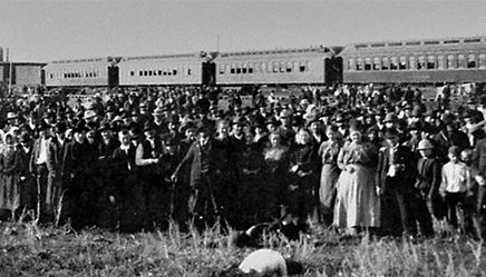
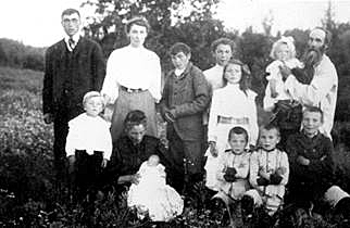
Around the year 1900, thousands of Eastern European (present-day Ukraine, Poland and Russia) immigrants came to Manitoba and were sent to the Immigration Hall at East Selkirk to live until they were able to secure a homestead. Listen to the story of one such Ukrainian family.
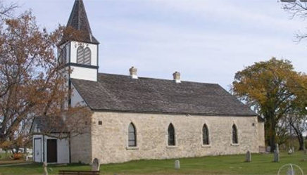
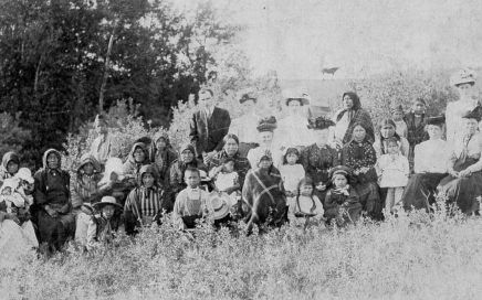
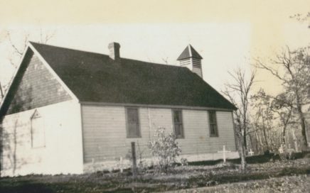
Built in 1851, this limestone church was built for 87 indigenous families in the community known as Indian Settlement and is still running to this day. It is a now a national historic site.
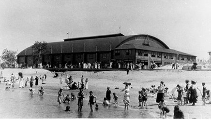
On the south east corner of Lake Winnipeg is the village and cottage community of Grand Marais, so named by explorer LaVérendrye in 1736 meaning “the big marsh”. It began as a Métis community, became a busy railroad resort town in the early 1900s, and is now home to many cottagers and a popular provincial park.
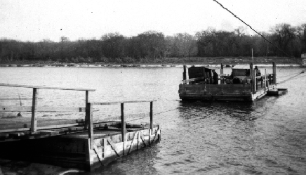
Before roads, the Red River was the main transportation corridor in the area. People settled along the river on both sides. Before bridges were built in early 1900, people crossed the river by ferry or boat.
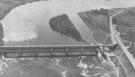
St. Andrews Lock and Dam was built on a grand vision to expand the shipping industry from Winnipeg to Lake Winnipeg and even into Saskatchewan by making a 5 km stretch of rapids north of Lockport navigable. This vision never came to fruition due to improvements in roads that made overland shipping a better option.
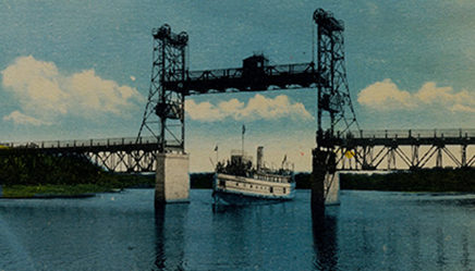
In the 1930s, there was still no bridge over the Red River in Selkirk. The government of the east side of the river claimed the ferry had been used over 50,000 times by its residents and a bridge had to be built. The federal government built one during the depression as a work relief project. It was to be a toll bridge but residents didn’t agree so took matters into their own hands.
Thousands of people drive past this site everyday, yet few of them are aware of a local tragedy took place here. On this site stood a dynamite factory for over 40 years that supplied explosives for mines in Canada west of the Great Lakes of Ontario. On August 29, 1945, an accidental explosion took the lives of three men while they were working cleaning the cartridge-filling machine.
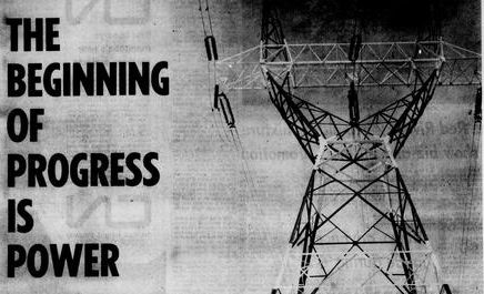
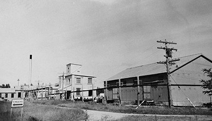
The Selkirk Generating Station is the second largest thermal-electric generating station in Manitoba. It is located on the east side of the Red River, adjacent to East Selkirk, about 40 km (24 miles) from Winnipeg. It has a thermal capacity of some 132,000 kilowatts while its gas turbines generate about 25,000 kilowatts. Construction began May…
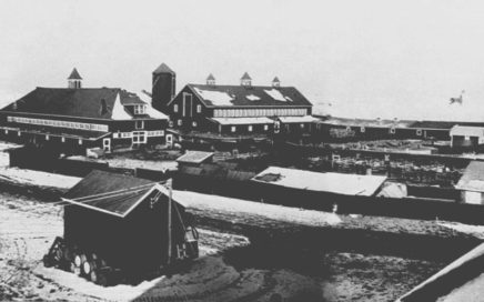
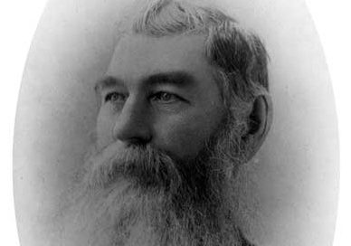
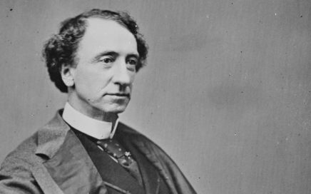
Sir William Cornelius Van Horne a legend in Canadian history and is famous for his work on the Canadian Pacific and other railways. He was a Renaissance man whose interests carried him into, among other things, farming. The farm he owned in St. Clements was a noteworthy landmark for decades. Under his leadership the Canadian…
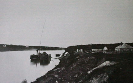
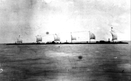
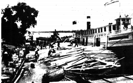
The most famous steamship to travel the Red River was called the SS Colvile. It was considered one of the greatest ships that the Hudson’s Bay Company had ever constructed. When the HBC decided to build a harbour in the East Slough at East Selkirk, they decided to name the harbour after this great vessel….
Floods have always been a fact of life for Manitobans. In colonial days, settlers would flee to high ground at places like Bird’s Hill. In the 1900s, however, Manitoba’s population boomed and its building infrastructure expanded. The Great Flood of 1950 saw over 10,500 homes flooded (1/10th of Winnipeg). The great potential damage future floods…
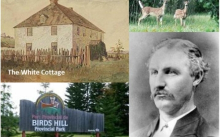
Bird’s Hill was named for James Bird, who received a sizable land grant in the area upon retirement from the Company. He and his son Curtis both served in high positions in early Manitoba politics. The Bird’s Hill geocache site is located near St. Clements, Manitoba at GPS coordinates N 50° 02.518 W 096° 54.868….
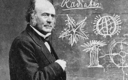
Members of the Gunn family were important figures in early Manitoba. Donald and his son John played important roles in religion, politics, education, science, and enterprise. Built in the 1850’s, Gunn’s flourmill was a local center of industry and commerce. The power for this flourmill came from the spring-thaw waters that flowed down Gunn’s Creek to…
Presbyterians have been prominent in Manitoba’s political, social, economic, and religious history since the start of colonial times. MacKenzie Presbyterian Church was their meeting place in St. Clements. In 1919 Mary MacKenzie moved to East St. Clements at the age of 58. Although she had planned to retire as the widow of Reverend Ewan MacKenzie,…
Beaconia is located off the junction of road 98 North and Provincial road 500 in the RM of St. Clements. This out of the way little cove was named for an out of the ordinary little character. August Larson, otherwise known as “The Little Dane,” arrived in Beaconia some time before 1910. He was a…
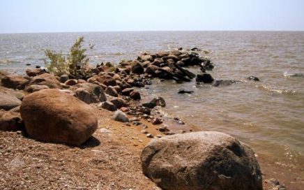
What is today rich farmland and delightful bush was once covered by a vast glacier and the lake that came out of it. Located along Lake Winnipeg, Grand Beach Provincial Park contains some of the most beautiful sandy beaches in North America. However, unknown to many, this area was once home to an ancient beach that…
As an Anglican congregation in a thinly populated, non-Anglican area, the experience of St. Jude’s was different from that of most Anglican Churches in the province. St. Jude’s Anglican Church is located on the corner of Sunset Avenue and Grey Avenue in the community of Grand Marais. The first landowners of Grand Marais, Gilbert and…
The Rowley house stood on CIL road, near the CIL Dynamite Plant. It was a large, 6-bedroom house with a lovely well and a large garden, and was owned by a man called Alexander Butler Rowley. AB Rowley came to Canada in 1885 as a volunteer to settle the Saskatchewan Rebellion. Though trained to be a…
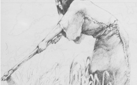
Located 21 km north of Winnipeg, the Kenosewun Visitor Centre and Museum is dedicated to the preservation of the archeological heritage of St. Clements. The museum is closed but the site is open to the public from mid-May to early September. The name “Kenosewun” means “place of many fishes” and was so named because of the…
Sanford Fleming – Engineer-in-Chief and surveyor for the Canadian Pacific Railway, inventor of time zones, designer of Canada’s first postage stamp – originally chose Selkirk for the railway crossing over the Red River. In 1879, with the construction of the East Selkirk Roundhouse, Selkirk residents felt a great deal of anticipation about the coming railway. …
Today most Canadians can easily identify the size and shape of the Province of Manitoba. However, when the province was first created it was only 1/18th of its current size. The original boundaries of the Province of Manitoba made it look like a fine little postage stamp on the map of the Dominion of Canada. …
One hundred years ago, ambitious businessmen like William Robinson and William Purvis left their marks on the shores of Lake Winnipeg. Located along the La Vérendrye Trail (PTH #12), Grand Marais is the northernmost town in the Rural Municipality of St. Clements. First Nations peoples originally inhabited the region because of the abundance of fish…